Hurricane Matthew came at Florida as one of the strongest and deadliest hurricanes in almost 12 years. But are we in the clear?
The latest satellite images show that Matthew has almost made its way out of Florida leaving behind most of the east coast under water while Lake, Marion, Sumter, and Citrus counties experienced some rain, heavy winds, downed trees, power outages, and damage to some homes.
Although most people are relieved that the worst is past us, weather experts say it may not be over.
According to the latest path forecast for Matthew, he is expected to loop back around and hit Florida again around Monday.
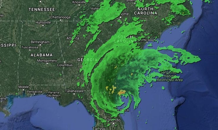
Hurricane Matthew, which is currently a category 3 hurricane with maximum winds of up to 115 mph is currently just off of the coast of Jacksonville making its way along the east coast of Georgia and South Carolina before looping back into the Atlantic Ocean to make its way back to Florida as a Tropical Storm.
The current forecast shows it is expected to go somewhere between South Florida and The Bahamas but can change depending on the effects of the newly developed Tropical Storm Nicole just east of Matthew.

It is recommended that residents stay vigilant and keep an eye on the news for further information. Be sure to stay stocked on supplies as well. Although it may not hit us hard the second time, we will still be vulnerable to loss of power, flooding, and heavy rains.
Comments are closed.